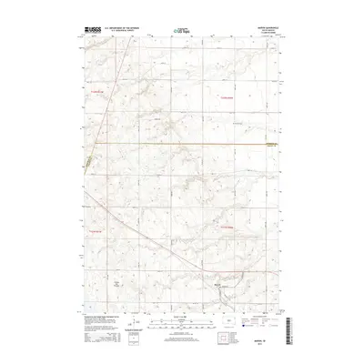
2015 Map of Marvin
USGS Topo · Published 2015About this map
Marvin serves as the primary settlement hub in this 2015 survey, situated near the intersection of Marvin Rd, Church St, and Division St. The landscape is dominated by the distinctive geological formation known as the Coteau des Prairies, a high plateau that rises above the surrounding plains. This terrain influence is visible in the undulating contour lines and the network of section-line roads like 461st Ave and 146th St that navigate the slopes.
Find a feature on this map
27 named features on this map. Tap any name to fly to it.
Don’t see what you’re looking for? This feature index may not catch every label — zoom into the map to look around manually.
Map Details
Editions of this 2015 Marvin Map
This is the sole edition of this map. No revisions or reprints were ever made.
Other maps of this area

1953 · Milbank
USGS Topo · 1:250,000

1958 · Milbank
USGS Topo · 1:250,000

1970 · Summit
USGS Topo · 1:24,000

1970 · Summit NE
USGS Topo · 1:24,000

1970 · Marvin
USGS Topo · 1:24,000

1970 · Wilmot NW
USGS Topo · 1:24,000

1970 · Still Lake NE
USGS Topo · 1:24,000

1971 · Corona
USGS Topo · 1:24,000
1971 · Wilmot
USGS Topo · 1:24,000

1973 · Twin Brooks
USGS Topo · 1:24,000