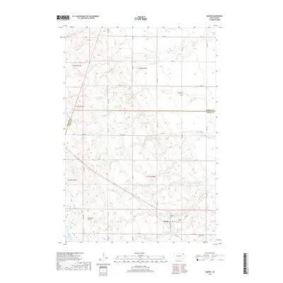
2017 Map of Marvin
USGS Topo · Published 2017About this map
The Marvin settlement sits atop the striking geological rise of the Coteau des Prairies, an expansive highland that dominates this portion of South Dakota. In 2017, the landscape reveals a clear division between the upland plateau and the surrounding plains, marked by a sparse network of county roads like Co RD 16 and Co HWY 2. For those researching local history or genealogy, the map identifies several distinct burial grounds, including the Eastman Cem and the Blue Cloud Abbey Cem, alongside the dual locations of Osceola 1 Cem and Osceola 2 Cem. These landmarks, along with Twin Lakes at the southern margin, provide a detailed look at the rural character of Grant County and the adjacent Roberts County border during the early 21st century.
Find a feature on this map
28 named features on this map. Tap any name to fly to it.
Don’t see what you’re looking for? This feature index may not catch every label — zoom into the map to look around manually.
Map Details
Editions of this 2017 Marvin Map
This is the sole edition of this map. No revisions or reprints were ever made.
Other maps of this area

1953 · Milbank
USGS Topo · 1:250,000

1958 · Milbank
USGS Topo · 1:250,000

1970 · Summit
USGS Topo · 1:24,000

1970 · Summit NE
USGS Topo · 1:24,000

1970 · Marvin
USGS Topo · 1:24,000

1970 · Wilmot NW
USGS Topo · 1:24,000

1970 · Still Lake NE
USGS Topo · 1:24,000

1971 · Corona
USGS Topo · 1:24,000
1971 · Wilmot
USGS Topo · 1:24,000

1973 · Twin Brooks
USGS Topo · 1:24,000