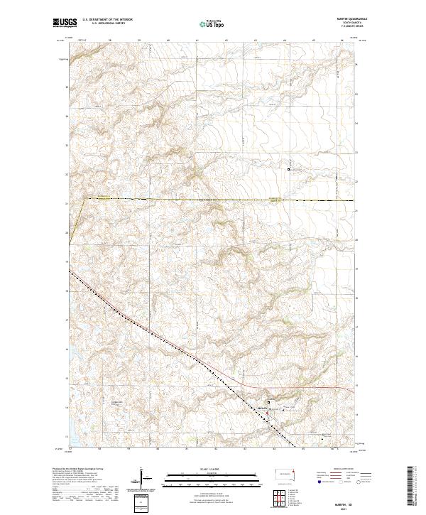
2021 Map of Marvin
USGS Topo · Published 2021About this map
Marvin sits within the complex glacial topography of the Coteau des Prairies, a high plateau rising above the surrounding plains. This 2021 survey documents the small settlement and its surrounding agricultural landscape in northeastern South Dakota, marking the border between Roberts and Grant counties. The map is particularly useful for genealogists, as it identifies several distinct burial sites including Eastman Cem, Osceola 1 Cem, and Osceola 2 Cem, along with the Blue Cloud Abbey Cem to the southeast. The section-line road network, including 462nd Ave and County Highway 2, cuts across the varied elevation of the Coteau, leading toward the Twin Lakes at the southwestern edge of the quadrangle. This detailed look at the rural township structure captures the enduring placement of these community landmarks within a sparsely populated prairie environment.
Find a feature on this map
31 named features on this map. Tap any name to fly to it.
Don’t see what you’re looking for? This feature index may not catch every label — zoom into the map to look around manually.
Map Details
Editions of this 2021 Marvin Map
This is the sole edition of this map. No revisions or reprints were ever made.
Other maps of this area

1953 · Milbank
USGS Topo · 1:250,000

1958 · Milbank
USGS Topo · 1:250,000

1970 · Summit
USGS Topo · 1:24,000

1970 · Summit NE
USGS Topo · 1:24,000

1970 · Marvin
USGS Topo · 1:24,000

1970 · Wilmot NW
USGS Topo · 1:24,000

1970 · Still Lake NE
USGS Topo · 1:24,000

1971 · Corona
USGS Topo · 1:24,000
1971 · Wilmot
USGS Topo · 1:24,000

1973 · Twin Brooks
USGS Topo · 1:24,000