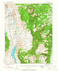
1945 Map of Marysvale
USGS Topo · Published 1965About this map
The Sevier River valley serves as a vital corridor through the high-desert terrain of central Utah, anchoring a network of small settlements and industrial outposts. The Denver and Rio Grande Western railroad tracks parallel the river, reaching northward through Marysvale and Thompsonville. This infrastructure supported early-to-mid-20th-century extraction efforts, most notably at the Whitehorse Mine in the White Hills and the settlement of Alunite.
Find a feature on this map
73 named features on this map. Tap any name to fly to it.
Don’t see what you’re looking for? This feature index may not catch every label — zoom into the map to look around manually.
Map Details
Editions of this 1945 Marysvale Map
3 editions found
Other maps of this area

1885 · Beaver
USGS Topo · 1:250,000

1885 · Fish Lake
USGS Topo · 1:250,000

1896 · Fish Lake
USGS Topo · 1:250,000

1932 · Sevier
USGS Topo · 1:62,500

1935 · Sevier
USGS Topo · 1:62,500

1937 · Delano Peak
USGS Topo · 1:48,000

1940 · Monroe
USGS Topo · 1:62,500

1943 · Delano Peak
USGS Topo · 1:62,500

1944 · Monroe
USGS Topo · 1:62,500

1945 · Marysvale
USGS Topo · 1:62,500