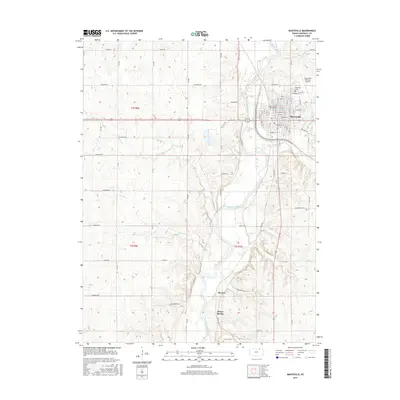
2015 Map of Marysville
USGS Topo · Published 2015About this map
Marysville serves as the primary hub of this landscape, situated at the bend of the Big Blue River. The town's grid is well-defined by a network of local streets such as Laramie St and Carolina St, while the Marysville Cem and Marysville Municipal Airport mark the northern and eastern outskirts. To the south, the terrain becomes more varied as it follows the river valley toward the settlement of Shroyer.
Find a feature on this map
36 named features on this map. Tap any name to fly to it.
Don’t see what you’re looking for? This feature index may not catch every label — zoom into the map to look around manually.
Map Details
Editions of this 2015 Marysville Map
This is the sole edition of this map. No revisions or reprints were ever made.
Other maps of this area

1889 · Marysville
USGS Topo · 1:125,000

1894 · Marysville
USGS Topo · 1:125,000

1955 · Manhattan
USGS Topo · 1:250,000

1956 · Manhattan
USGS Topo · 1:250,000

1957 · Manhattan
USGS Topo · 1:250,000

1966 · Oketo
USGS Topo · 1:24,000

1966 · Marysville
USGS Topo · 1:24,000

1966 · Hanover SE
USGS Topo · 1:24,000
1966 · Herkimer
USGS Topo · 1:24,000

1966 · Home
USGS Topo · 1:24,000