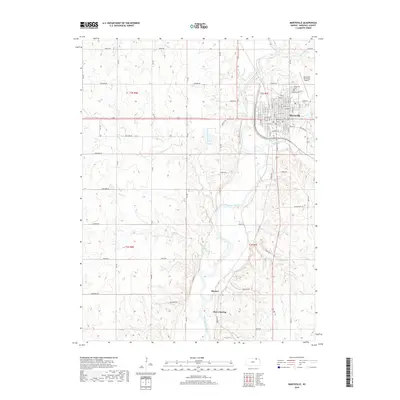
2018 Map of Marysville
USGS Topo · Published 2018About this map
The Big Blue River anchors this study of Marshall County, winding through a landscape of prairie drainages including Dutch Cr, Hop Cr, and Rocky Run. The city of Marysville sits at the northeastern corner, its street grid detailed from Alston St to Otoe St, serving as the primary hub of the region. South of the main settlement, the smaller community of Shroyer is situated near the riverbanks, marking a quieter reach of the valley.
Find a feature on this map
37 named features on this map. Tap any name to fly to it.
Don’t see what you’re looking for? This feature index may not catch every label — zoom into the map to look around manually.
Map Details
Editions of this 2018 Marysville Map
This is the sole edition of this map. No revisions or reprints were ever made.
Other maps of this area

1889 · Marysville
USGS Topo · 1:125,000

1894 · Marysville
USGS Topo · 1:125,000

1955 · Manhattan
USGS Topo · 1:250,000

1956 · Manhattan
USGS Topo · 1:250,000

1957 · Manhattan
USGS Topo · 1:250,000

1966 · Oketo
USGS Topo · 1:24,000

1966 · Marysville
USGS Topo · 1:24,000

1966 · Hanover SE
USGS Topo · 1:24,000
1966 · Herkimer
USGS Topo · 1:24,000

1966 · Home
USGS Topo · 1:24,000