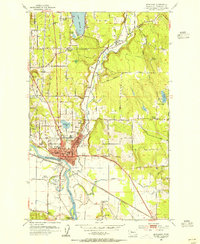
1956 Map of Marysville
USGS Topo · Published 1969About this map
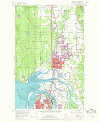
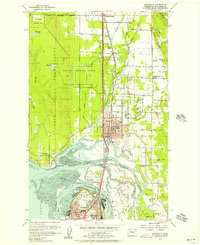
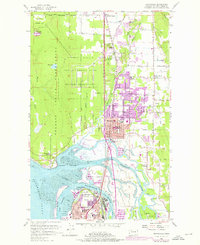
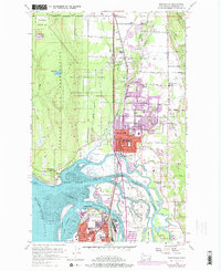
Tulalip Indian Reservation lands dominate the western landscape of this survey, where the Tulalip Storage Depot stands as a significant military installation. The town of Marysville serves as the central hub, situated where the Great Northern railroad line runs parallel to the intricate tidal waterways of the Snohomish River delta. The 1968 purple revisions indicate suburban expansion into the surrounding foothills and marshes, notably around Cedarcrest and the area near Kellogg Marsh Grange.
Find a feature on this map
57 named features on this map. Tap any name to fly to it.
Don’t see what you’re looking for? This feature index may not catch every label — zoom into the map to look around manually.
Map Details
Editions of this 1956 Marysville Map
4 editions found
Other maps of this area

1895 · Snohomish
USGS Topo · 1:125,000

1897 · Seattle
USGS Topo · 1:125,000

1911 · Mount Vernon
USGS Topo · 1:125,000

1941 · Marysville
USGS Topo · 1:62,500

1942 · Edmonds
USGS Topo · 1:62,500

1943 · Marysville
USGS Topo · 1:62,500

1943 · Stanwood
USGS Topo · 1:62,500

1944 · Everett
USGS Topo · 1:62,500
1953 · Snohomish
USGS Topo · 1:24,000
1953 · Mukilteo
USGS Topo · 1:24,000