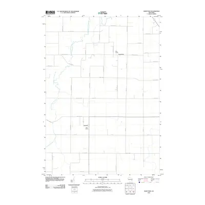
2010 Map of Marytown
USGS Topo · Published 2010About this map
The South Branch Manitowoc River meanders through this agricultural landscape, anchoring the rural communities of Calumet County during the early 21st century. The settlement of Marytown serves as a central point for the region, defined by its grid of country roads and the prominent Saint Marys Cemetery. Further north, the village of Charlesburg sits at the junction of Saint Charles Rd and County Hwy-G, situated near Saint Charles Cemetery. This document reveals the enduring rural character of the area, where land divisions follow a strict section-line grid established long before. For local historians and genealogists, the map provides a precise look at property access via a network of named thoroughfares like Kiel Rd, County Hwy-HH, and County Hwy-Q, which connect the scattered farmsteads and parish centers of this Wisconsin farming heartland.
Find a feature on this map
34 named features on this map. Tap any name to fly to it.
Don’t see what you’re looking for? This feature index may not catch every label — zoom into the map to look around manually.
Map Details
Editions of this 2010 Marytown Map
This is the sole edition of this map. No revisions or reprints were ever made.
Other maps of this area

1910 · Fond du Lac
USGS Topo · 1:62,500

1911 · Neenah
USGS Topo · 1:62,500

1954 · Chilton
USGS Topo · 1:62,500

1954 · Kiel
USGS Topo · 1:62,500

1955 · Neenah
USGS Topo · 1:62,500

1955 · Fond Du Lac
USGS Topo · 1:62,500

1955 · Green Bay
USGS Topo · 1:250,000

1957 · Madison
USGS Topo · 1:250,000

1960 · Madison
USGS Topo · 1:250,000

1974 · St. Cloud
USGS Topo · 1:24,000