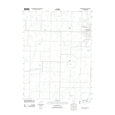
2011 Map of Maryville West
USGS Topo · Published 2011About this map
Maryville stands as the primary hub of this Missouri landscape, with the expansive campus of Northwest Missouri State University defining the city’s western edge. The surrounding terrain in Polk Township is deeply agricultural, marked by the long-established Nodaway County Farm and smaller settlements like Bell Grove. The drainage pattern is complex, shaped by the winding courses of White Cloud Creek and Big Slough, while Shelton Lake and Houston Lake provide significant local water features. For those researching local family history, several prominent burial grounds are documented, including Cain Cemetery to the north, Morgan Cemetery, and White Cloud Cemetery in the southern reaches. The presence of Maryville Memorial Airport and a grid of secondary roads like Fortune Rd and Icon Rd show the area's development as an aviation and transit center for the county.
Find a feature on this map
51 named features on this map. Tap any name to fly to it.
Don’t see what you’re looking for? This feature index may not catch every label — zoom into the map to look around manually.
Map Details
Editions of this 2011 Maryville West Map
This is the sole edition of this map. No revisions or reprints were ever made.
Other maps of this area

1926 · Maitland
USGS Topo · 1:62,500

1927 · Bolckow
USGS Topo · 1:62,500

1939 · Skidmore
USGS Topo · 1:62,500

1941 · Skidmore
USGS Topo · 1:62,500

1942 · Skidmore
USGS Topo · 1:62,500

1943 · Maryville
USGS Topo · 1:62,500

1945 · Bolckow
USGS Topo · 1:62,500

1955 · Nebraska City
USGS Topo · 1:250,000

1957 · Nebraska City
USGS Topo · 1:250,000

1958 · Nebraska City
USGS Topo · 1:250,000