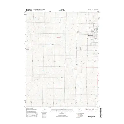
2014 Map of Maryville West
USGS Topo · Published 2014About this map
The western edge of Maryville and the campus of Northwest Missouri State Univ define the eastern margin of this Nodaway County landscape. Moving west, the terrain transitions into a organized grid of rural section roads, including Fortune Rd and Galaxy Rd, which navigate the various branches of White Cloud Cr and Elkhorn Cr. The map captures the agricultural character of the region, punctuated by small community landmarks like the settlement of Bell Grove and the Northwest Missouri Regional Airport. Local genealogy is well-represented through several rural burial sites, including Cain Cemetery near the northern border and Morgan Cemetery further south. Man-made water features such as Shelton Lake and Houston Lake provide notable landmarks amidst the undulating creek valleys and till plains of the Missouri interior.
Find a feature on this map
62 named features on this map. Tap any name to fly to it.
Don’t see what you’re looking for? This feature index may not catch every label — zoom into the map to look around manually.
Map Details
Editions of this 2014 Maryville West Map
This is the sole edition of this map. No revisions or reprints were ever made.
Other maps of this area

1926 · Maitland
USGS Topo · 1:62,500

1927 · Bolckow
USGS Topo · 1:62,500

1939 · Skidmore
USGS Topo · 1:62,500

1941 · Skidmore
USGS Topo · 1:62,500

1942 · Skidmore
USGS Topo · 1:62,500

1943 · Maryville
USGS Topo · 1:62,500

1945 · Bolckow
USGS Topo · 1:62,500

1955 · Nebraska City
USGS Topo · 1:250,000

1957 · Nebraska City
USGS Topo · 1:250,000

1958 · Nebraska City
USGS Topo · 1:250,000