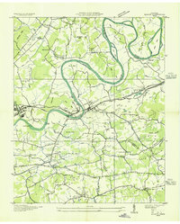
1935 Map of Mascot
USGS Topo · Published 1935About this map
The Holston River carves a winding path through this 1935 landscape, defining the boundaries of Knox, Jefferson, and Grainger counties. The Southern Railway and the Andrew Johnson Highway run parallel through the river valley, serving the industrial and agricultural hubs of Mascot and Strawberry Plains. This era of development is marked by the presence of a Public Service Company transmission line and an Airway Beacon, showing the integration of modern infrastructure into a traditional rural setting.
Find a feature on this map
67 named features on this map. Tap any name to fly to it.
Don’t see what you’re looking for? This feature index may not catch every label — zoom into the map to look around manually.
Map Details
Editions of this 1935 Mascot Map
This is the sole edition of this map. No revisions or reprints were ever made.
Other maps of this area

1886 · Knoxville
USGS Topo · 1:125,000

1892 · Knoxville
USGS Topo · 1:125,000

1894 · Knoxville
USGS Topo · 1:125,000

1895 · Knoxville
USGS Topo · 1:125,000

1897 · Maynardville
USGS Topo · 1:125,000

1900 · Maynardville
USGS Topo · 1:125,000

1901 · Knoxville
USGS Topo · 1:125,000
1935 · Luttrell
USGS Topo · 1:24,000

1935 · Knoxville
USGS Topo · 1:48,000

1935 · Straw Plains
USGS Topo · 1:48,000