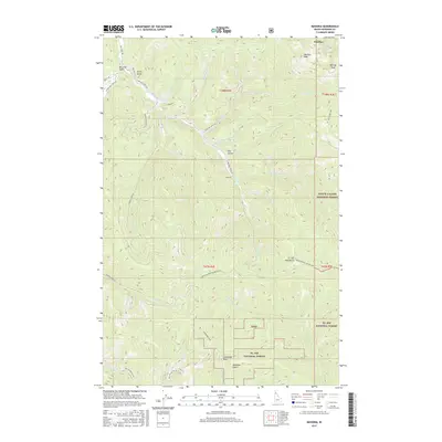
2017 Map of Masonia
USGS Topo · Published 2017About this map
Wardner and Masonia sit at the northern edge of this high-elevation terrain within Shoshone County, where the landscape is defined by the steep drainages of the St. Joe Mountains. The map documents a complex network of forest roads and trails that traverse the divide between the Coeur d'Alene National Forest and the St. Joe National Forest. Notable summits like Wardner Peak, Kellogg Peak, and Lemonade Peak tower over a series of narrow gulches, including McLaren Gulch and the ominously named Deadman Gulch. Steep creek beds such as Nabob Cr, Blue Eagle Cr, and Pine Cr cut through the timbered slopes, reflecting the region's rugged geography. This survey provides a modern look at the remote interior of the Idaho Panhandle, tracing established routes like the Coeur d'Alene Divide NRT 8 and St Joe Divide NRT across the ridge lines.
Find a feature on this map
44 named features on this map. Tap any name to fly to it.
Don’t see what you’re looking for? This feature index may not catch every label — zoom into the map to look around manually.
Map Details
Editions of this 2017 Masonia Map
This is the sole edition of this map. No revisions or reprints were ever made.
Other maps of this area

1901 · Coeur D'Alene District
USGS Topo · 1:62,500

1903 · Coeur D'Alene District
USGS Topo · 1:62,500

1906 · Coeur D'Alene District
USGS Topo · 1:62,500

1909 · Cataldo
USGS Topo · 1:125,000

1911 · Cataldo
USGS Topo · 1:125,000

1950 · Twin Crags
USGS Topo · 1:24,000

1952 · Twin Crags
USGS Topo · 1:24,000

1955 · Spokane
USGS Topo · 1:250,000

1957 · Kingston
USGS Topo · 1:62,500

1957 · Kellogg
USGS Topo · 1:62,500