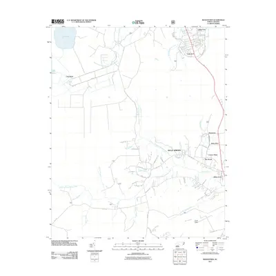
2011 Map of Masontown
USGS Topo · Published 2011About this map
Masontown and its surrounding residential developments sit within a complex network of coastal lowlands and drainage basins defined by the Northwest Prong Newport River and the Southwest Prong Slocum Creek. The 2011 landscape reflects significant modern suburban growth near Havelock, with neighborhoods like Trent Acres, College Park, and Hilltop Acres established amidst the older terrain. To the west, the topography transitions into a more hydrologically diverse area featuring Little Lake and Lake Ellis Simon, connected by managed waterways such as Canal Rd and Lake Rd. The intricate hydrography of the region is evident in the many named branches and swamps, including Milldam Branch, Millis Swamp, and Reak Swamp, which dictate the placement of local thoroughfares like Nine Foot Rd. Further south, the presence of the Carteret County Landfill marks the edge of local infrastructure near Cedar Swamp Creek.
Find a feature on this map
83 named features on this map. Tap any name to fly to it.
Don’t see what you’re looking for? This feature index may not catch every label — zoom into the map to look around manually.
Map Details
Editions of this 2011 Masontown Map
This is the sole edition of this map. No revisions or reprints were ever made.
Other maps of this area

1942 · Maysville
USGS Topo · 1:62,500

1942 · Swansboro
USGS Topo · 1:62,500

1948 · Maysville
USGS Topo · 1:62,500

1948 · Swansboro
USGS Topo · 1:62,500

1949 · Havelock
USGS Topo · 1:24,000

1949 · Newport
USGS Topo · 1:24,000

1949 · Salter Path
USGS Topo · 1:24,000

1949 · Mansfield
USGS Topo · 1:24,000

1949 · Cherry Point
USGS Topo · 1:24,000

1949 · Masontown
USGS Topo · 1:24,000