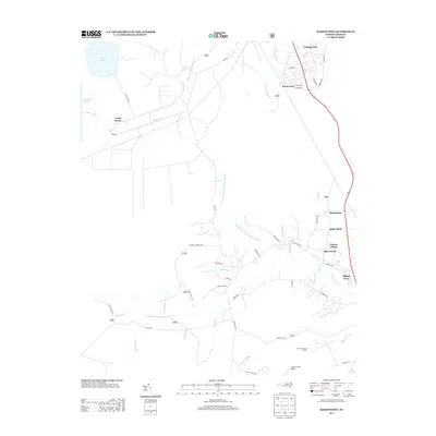
2013 Map of Masontown
USGS Topo · Published 2013About this map
Camp Bryan and the northern reaches of the Croatan National Forest define this coastal Carolina landscape, where managed woodlands meet the intricate headwaters of the Newport and Slocum rivers. The 2013 survey shows the expansion of residential clusters such as Trent Acres, Masontown, and Ashley Place along the corridor east of the marshy interior. In the northwest, the large basins of Little Lake and Lake Ellis Simon are linked by the North Canal and Middle Canal, reflecting a history of regional water management and land reclamation.
Find a feature on this map
61 named features on this map. Tap any name to fly to it.
Don’t see what you’re looking for? This feature index may not catch every label — zoom into the map to look around manually.
Map Details
Editions of this 2013 Masontown Map
This is the sole edition of this map. No revisions or reprints were ever made.
Other maps of this area

1942 · Maysville
USGS Topo · 1:62,500

1942 · Swansboro
USGS Topo · 1:62,500

1948 · Maysville
USGS Topo · 1:62,500

1948 · Swansboro
USGS Topo · 1:62,500

1949 · Havelock
USGS Topo · 1:24,000

1949 · Newport
USGS Topo · 1:24,000

1949 · Salter Path
USGS Topo · 1:24,000

1949 · Mansfield
USGS Topo · 1:24,000

1949 · Cherry Point
USGS Topo · 1:24,000

1949 · Masontown
USGS Topo · 1:24,000