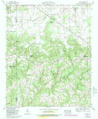
1960 Map of Massey
USGS Topo · Published 1988About this map
Brindley Mountain and the deep incisions of Corn Valley dominate this landscape on the border of Morgan and Cullman counties. The map illustrates a rural Alabamian territory defined by its complex ridge-and-hollow topography, where small settlements like Massey and Battleground are linked by historic thoroughfares such as the Old Tennessee Road. This 1960s-era record, updated through 1987, reveals the deep-rooted social fabric of the area through its numerous country churches, including Provident Ch and Mt Nebo Ch, and family-named cemeteries like Herrin Cem.
Find a feature on this map
66 named features on this map. Tap any name to fly to it.
Don’t see what you’re looking for? This feature index may not catch every label — zoom into the map to look around manually.
Map Details
Editions of this 1960 Massey Map
4 editions found
Other maps of this area

1888 · Cullman
USGS Topo · 1:125,000

1892 · Cullman
USGS Topo · 1:125,000

1927 · Falkville
USGS Topo · 1:24,000

1935 · Upshaw
USGS Topo · 1:24,000

1935 · Danville
USGS Topo · 1:48,000

1935 · Oakville
USGS Topo · 1:24,000

1936 · Mc Kendry
USGS Topo · 1:24,000

1936 · Hartselle
USGS Topo · 1:24,000

1936 · Stroups Crossroads
USGS Topo · 1:24,000

1938 · Danville
USGS Topo · 1:62,500