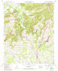
1948 Map of Masterson
USGS Topo · Published 1973About this map
Masterson Mill sits at the heart of the Moulton Valley in this survey based on 1940s field work with 1970s revisions. The landscape is defined by the sharp transition from the flat valley floor to the steep elevations of Courtland Mountain and Bash Mountain. This topography dictated the settlement patterns of Lawrence County, with family-named hollows like Moats Hollow and Hightower Hollow tucking into the ridges.
Find a feature on this map
66 named features on this map. Tap any name to fly to it.
Don’t see what you’re looking for? This feature index may not catch every label — zoom into the map to look around manually.
Map Details
Editions of this 1948 Masterson Map
This is the sole edition of this map. No revisions or reprints were ever made.
Other maps of this area

1935 · Moulton
USGS Topo · 1:24,000

1935 · Danville
USGS Topo · 1:48,000

1935 · Oakville
USGS Topo · 1:24,000

1936 · Caddo
USGS Topo · 1:24,000

1936 · Courtland
USGS Topo · 1:24,000

1936 · Hillsboro
USGS Topo · 1:24,000

1936 · Moulton
USGS Topo · 1:48,000

1936 · Town Creek
USGS Topo · 1:24,000

1936 · Masterson
USGS Topo · 1:24,000

1936 · Hatton
USGS Topo · 1:24,000