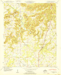
1951 Map of Masterson
USGS Topo · Published 1951About this map
Masterson Mill sits along the Turkey Creek drainage, serving as a focal point for the rural communities of northern Alabama in the years following World War II. The landscape is defined by the transition from the high, dissected terrain of Courtland Mountain and Summerhouse Mountain down into the broad agricultural reaches of the Moulton Valley. This area is characterized by a dense network of family-named landmarks and small-scale infrastructure, including several timber or masonry crossings such as the Stickmeyer Bridge and John R Bridge.
Find a feature on this map
81 named features on this map. Tap any name to fly to it.
Don’t see what you’re looking for? This feature index may not catch every label — zoom into the map to look around manually.
Map Details
Editions of this 1951 Masterson Map
This is the sole edition of this map. No revisions or reprints were ever made.
Other maps of this area

1935 · Moulton
USGS Topo · 1:24,000

1935 · Danville
USGS Topo · 1:48,000

1935 · Oakville
USGS Topo · 1:24,000

1936 · Caddo
USGS Topo · 1:24,000

1936 · Courtland
USGS Topo · 1:24,000

1936 · Hillsboro
USGS Topo · 1:24,000

1936 · Moulton
USGS Topo · 1:48,000

1936 · Town Creek
USGS Topo · 1:24,000

1936 · Masterson
USGS Topo · 1:24,000

1936 · Hatton
USGS Topo · 1:24,000