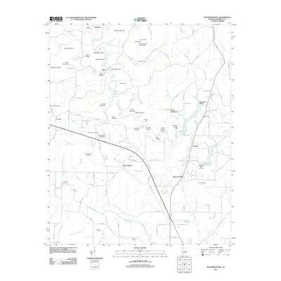
2011 Map of Masterson Mill
USGS Topo · Published 2011About this map
Masterson Mill serves as a central landmark in this 2011 survey of Lawrence County, where small settlements and family-named landmarks define the landscape. The geography is characterized by numerous small peaks and ridges such as Mackeys Mountain, Bash Mountain, and Stickmeyer Mountain, which separate various hollows and creek branches. Genealogists will find a high density of burial sites including Terry Cemetery, Hawkins Cemetery, and Thompson Cemetery, reflecting generations of local families. The area is intersected by a network of county roads connecting established clusters like Letson Settlement, Mountain Home, and Mount Moriah. Water features play a significant role in the local topography, with Moulton City Lake and its associated dam situated near the confluence of Turkey Creek and Wade Creek. This modern survey provides a clear view of the rural infrastructure, including crossings like Jack Locke Bridge and Trace Ford along the Muddy Fork and its tributaries.
Find a feature on this map
132 named features on this map. Tap any name to fly to it.
Don’t see what you’re looking for? This feature index may not catch every label — zoom into the map to look around manually.
Map Details
Editions of this 2011 Masterson Mill Map
This is the sole edition of this map. No revisions or reprints were ever made.
Other maps of this area

1935 · Moulton
USGS Topo · 1:24,000

1935 · Danville
USGS Topo · 1:48,000

1935 · Oakville
USGS Topo · 1:24,000

1936 · Caddo
USGS Topo · 1:24,000

1936 · Courtland
USGS Topo · 1:24,000

1936 · Hillsboro
USGS Topo · 1:24,000

1936 · Moulton
USGS Topo · 1:48,000

1936 · Town Creek
USGS Topo · 1:24,000

1936 · Masterson
USGS Topo · 1:24,000

1936 · Hatton
USGS Topo · 1:24,000