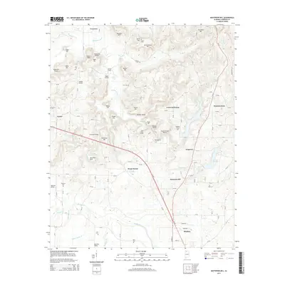
2014 Map of Masterson Mill
USGS Topo · Published 2014About this map
Masterson Mill sits within a landscape defined by the branching tributaries of the Muddy Fork and Big Nance Creek in Lawrence County. This 2014 survey captures a rural Alabama topography where small settlements like Letson Settlement and Longtown are connected by a network of county roads. The terrain is marked by significant ridges and summits, including Bash Mtn and Horton Mtn, interspersed with named hollows such as Loosier Hollow and Bullpen Hollow. For those researching local family history, several small burial grounds are documented, including Thompson Cem and Wade Cem. The map illustrates the northern fringes of Moulton, including the Moulton City Lake, providing a clear look at the area's development and natural drainage patterns just before the mid-2010s.
Find a feature on this map
130 named features on this map. Tap any name to fly to it.
Don’t see what you’re looking for? This feature index may not catch every label — zoom into the map to look around manually.
Map Details
Editions of this 2014 Masterson Mill Map
This is the sole edition of this map. No revisions or reprints were ever made.
Other maps of this area

1935 · Moulton
USGS Topo · 1:24,000

1935 · Danville
USGS Topo · 1:48,000

1935 · Oakville
USGS Topo · 1:24,000

1936 · Caddo
USGS Topo · 1:24,000

1936 · Courtland
USGS Topo · 1:24,000

1936 · Hillsboro
USGS Topo · 1:24,000

1936 · Moulton
USGS Topo · 1:48,000

1936 · Town Creek
USGS Topo · 1:24,000

1936 · Masterson
USGS Topo · 1:24,000

1936 · Hatton
USGS Topo · 1:24,000