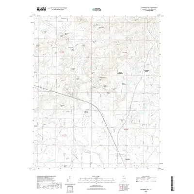
2018 Map of Masterson Mill
USGS Topo · Published 2018About this map
Masterson Mill sits within the drainage of the Clear Fork, anchor to a landscape of deep hollows and named ridges in northern Alabama. The terrain is defined by its numerous natural springs and sinks, including Horton Spring, Poplar Spring, and Spout Spring, which feed into the wider Big Nance Creek system. This 2018 survey reveals a settlement pattern of small communities like Mountain Home and Terrytown that have persisted around significant elevations like Mackey Mtn and Summerhouse Mtn. Genealogists will find several rural burial grounds documented, such as Dossey Cem and Thompson Cem, alongside family-named landmarks like John R Bridge and the Jack Locke Bridge. The presence of Moulton City Lake and the Moulton Valley area shows the modern expansion of the county seat northward, while names like Letson Settlement and Mount Moriah reflect the area’s longstanding agricultural roots.
Find a feature on this map
142 named features on this map. Tap any name to fly to it.
Don’t see what you’re looking for? This feature index may not catch every label — zoom into the map to look around manually.
Map Details
Editions of this 2018 Masterson Mill Map
This is the sole edition of this map. No revisions or reprints were ever made.
Other maps of this area

1935 · Moulton
USGS Topo · 1:24,000

1935 · Danville
USGS Topo · 1:48,000

1935 · Oakville
USGS Topo · 1:24,000

1936 · Caddo
USGS Topo · 1:24,000

1936 · Courtland
USGS Topo · 1:24,000

1936 · Hillsboro
USGS Topo · 1:24,000

1936 · Moulton
USGS Topo · 1:48,000

1936 · Town Creek
USGS Topo · 1:24,000

1936 · Masterson
USGS Topo · 1:24,000

1936 · Hatton
USGS Topo · 1:24,000