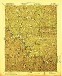
1917 Map of Matewan
USGS Topo · Published 1917About this map
The Tug Fork river defines this borderland landscape between West Virginia and Kentucky, serving as the industrial artery for the region's coal and transit sectors during the early twentieth century. The Norfolk and Western RR tightly follows the river's winding course, connecting a dense string of coal camps and settlements such as Merrimac, Matewan, and Thacker. This survey, completed in the years leading up to 1917, documents the infrastructure of the central Appalachian coalfields, including the Thacker Mines and various local post offices like Delorme Edgarton PO. Away from the river bottom, the map reveals a remote geography of ridges and hollows where rural life centered on small institutions like the Hatfield School and Blackberry Fork School. This period marks the height of the rail-and-river economy before modern highways transformed these isolated mountain communities.
Find a feature on this map
60 named features on this map. Tap any name to fly to it.
Don’t see what you’re looking for? This feature index may not catch every label — zoom into the map to look around manually.
Map Details
Editions of this 1917 Matewan Map
2 editions found
Other maps of this area

1886 · Grundy
USGS Topo · 1:125,000

1887 · Warfield
USGS Topo · 1:125,000

1890 · Grundy
USGS Topo · 1:125,000

1891 · Tazewell
USGS Topo · 1:125,000

1891 · Oceana
USGS Topo · 1:125,000

1891 · Warfield
USGS Topo · 1:125,000

1892 · Grundy
USGS Topo · 1:125,000

1893 · Oceana
USGS Topo · 1:125,000

1895 · Tazewell
USGS Topo · 1:125,000

1897 · Tazewell
USGS Topo · 1:125,000