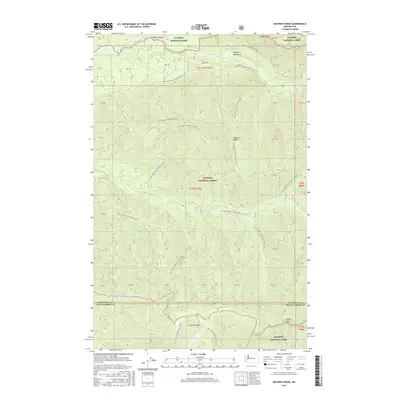
2017 Map of Matheny Ridge
USGS Topo · Published 2017About this map
Olympic National Forest and Olympic National Park define the geography of this remote portion of the Olympic Mountains. Centered on Matheny Ridge, the landscape is dominated by a complex network of forest development roads that trace the high contours and drainages of the Jefferson and Grays Harbor county line. The map illustrates the headwaters of several significant waterways, including Sams River to the north and the Middle Fork Salmon River to the south. This 2017 survey details the intensive infrastructure of the National Forest System, where named routes like Natl Forest Develop Road 2410 Rd provide access to high points such as Higley Peak. The intricate drainage patterns of Matheny Cr and Hook Br Cr underscore the region's high-elevation watershed importance within the protected federal lands.
Find a feature on this map
36 named features on this map. Tap any name to fly to it.
Don’t see what you’re looking for? This feature index may not catch every label — zoom into the map to look around manually.
Map Details
Editions of this 2017 Matheny Ridge Map
This is the sole edition of this map. No revisions or reprints were ever made.
Other maps of this area

1921 · Quinault Lake
USGS Topo · 1:62,500

1943 · Copalis Beach
USGS Topo · 1:250,000

1951 · Copalis Beach
USGS Topo · 1:250,000

1955 · Macafee Hill
USGS Topo · 1:62,500

1955 · Quinault Lake
USGS Topo · 1:62,500

1956 · Kloochman Rock
USGS Topo · 1:62,500

1956 · Salmon River
USGS Topo · 1:62,500

1957 · Copalis Beach
USGS Topo · 1:250,000

1958 · Seattle
USGS Topo · 1:250,000

1962 · Seattle
USGS Topo · 1:250,000