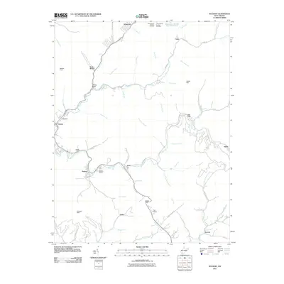
2011 Map of Matheny
USGS Topo · Published 2011About this map
The Clear Fork and Laurel Fork river valleys define the industrial and residential corridors of this West Virginia landscape. Settled pockets like Oceana, Matheny, and Kopperston follow the winding geography of the hollows, connected by routes like Glen Fork Rd and Bear Branch Rd. The topography is marked by significant resource management features, most notably the Kopperston Number Four Slurry Pond and the dams at Johns Branch Number One and Two. Genealogists may find interest in the Hillcrest Memorial Gardens near Matheny, while landmarks like Panther Knob and Adkins Gap provide fixed points in the deeply dissected terrain. The map captures a contemporary look at these mountain communities, where the proximity of settlements like Jesse and Glen Fork to the surrounding coal-country infrastructure remains a central characteristic of the local economy and development patterns.
Find a feature on this map
78 named features on this map. Tap any name to fly to it.
Don’t see what you’re looking for? This feature index may not catch every label — zoom into the map to look around manually.
Map Details
Editions of this 2011 Matheny Map
This is the sole edition of this map. No revisions or reprints were ever made.
Other maps of this area

1891 · Oceana
USGS Topo · 1:125,000

1891 · Raleigh
USGS Topo · 1:125,000

1893 · Oceana
USGS Topo · 1:125,000

1897 · Raleigh
USGS Topo · 1:125,000

1898 · Oceana
USGS Topo · 1:125,000

1902 · Raleigh
USGS Topo · 1:125,000

1910 · Pineville
USGS Topo · 1:48,000

1910 · Bald Knob
USGS Topo · 1:48,000

1911 · Marshes
USGS Topo · 1:48,000

1912 · Mullens
USGS Topo · 1:62,500