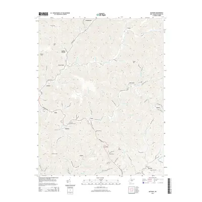
2014 Map of Matheny
USGS Topo · Published 2014About this map
Clear Fork and Laurel Fork define the drainage and settlement patterns of this Wyoming County landscape, where communities are deeply integrated with the narrow valleys of the Appalachian plateau. The settlement of Matheny serves as a central point, flanked by smaller hamlets such as Jesse and Edith. Local history is preserved at Hillcrest Memorial Gardens and the Glen Fork Cem, which sit alongside established transit corridors like the Appalachian Hwy and Kooperston Rd. The map illustrates a region where life follows the water, with nearly every named settlement, from Kopperston in the north to Keyrock in the southeast, situated at the confluence of mountain streams like Toney Fork and Coon Br. Steep ridges, including Huff Mtn and Panther Knob, isolate these valley communities, creating a distinct network of hollows and gaps.
Find a feature on this map
97 named features on this map. Tap any name to fly to it.
Don’t see what you’re looking for? This feature index may not catch every label — zoom into the map to look around manually.
Map Details
Editions of this 2014 Matheny Map
This is the sole edition of this map. No revisions or reprints were ever made.
Other maps of this area

1891 · Oceana
USGS Topo · 1:125,000

1891 · Raleigh
USGS Topo · 1:125,000

1893 · Oceana
USGS Topo · 1:125,000

1897 · Raleigh
USGS Topo · 1:125,000

1898 · Oceana
USGS Topo · 1:125,000

1902 · Raleigh
USGS Topo · 1:125,000

1910 · Pineville
USGS Topo · 1:48,000

1910 · Bald Knob
USGS Topo · 1:48,000

1911 · Marshes
USGS Topo · 1:48,000

1912 · Mullens
USGS Topo · 1:62,500