
2024 Map of Matinicus
USGS Topo · Published 2024About this map
Wooden Ball Island stands as a prominent outpost in this maritime landscape within the Atlantic Ocean. The island's geography is defined by landforms such as Stephens Head, Northwest Point, and the sandy stretch of Medrick Beach. Its coastline is indented by protected waters including Wood Cove, Frenchman Cove, and Back Cove, which suggest the natural harbors used by mariners in these Knox County waters.
Find a feature on this map
19 named features on this map. Tap any name to fly to it.
Don’t see what you’re looking for? This feature index may not catch every label — zoom into the map to look around manually.
Map Details
Editions of this 2024 Matinicus Map
This is the sole edition of this map. No revisions or reprints were ever made.
Other maps of this area

1906 · Matinicus
USGS Topo · 1:62,500

1948 · Bath
USGS Topo · 1:250,000
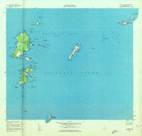
1953 · Matinicus
USGS Topo · 1:24,000

1956 · Bath
USGS Topo · 1:250,000

1957 · Bath
USGS Topo · 1:250,000

1958 · Bath
USGS Topo · 1:250,000

1963 · Bath
USGS Topo · 1:250,000
1965 · Bath
USGS Topo · 1:250,000
1985 · Matinicus
USGS Topo · 1:100,000
1994 · Matinicus
USGS Topo · 1:100,000