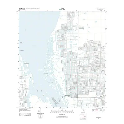
2012 Map of Matlacha
USGS Topo · Published 2012About this map
Matlacha Pass separates the mainland residential expansion of Cape Coral from the labyrinth of islands and mangroves characterizing this portion of Lee County. The map captures a transition between the dense, gridded suburban street networks of the mainland and the aquatic landscape of Charlotte Harbor. Settlements such as Matlacha Shores and Matlacha Isles sit at the edge of this transition, where the Pine Island Bridge provides the primary link across the water.
Find a feature on this map
180 named features on this map. Tap any name to fly to it.
Don’t see what you’re looking for? This feature index may not catch every label — zoom into the map to look around manually.
Map Details
Editions of this 2012 Matlacha Map
This is the sole edition of this map. No revisions or reprints were ever made.
Other maps of this area

1956 · Punta Gorda SE
USGS Topo · 1:24,000

1956 · West Palm Beach
USGS Topo · 1:250,000

1956 · Tampa
USGS Topo · 1:250,000

1956 · Charlotte Harbor
USGS Topo · 1:250,000

1957 · West Palm Beach
USGS Topo · 1:250,000

1957 · Punta Gorda SW
USGS Topo · 1:24,000

1957 · Gilchrist
USGS Topo · 1:24,000

1958 · West Palm Beach
USGS Topo · 1:250,000

1958 · Matlacha
USGS Topo · 1:24,000

1958 · Captiva
USGS Topo · 1:24,000