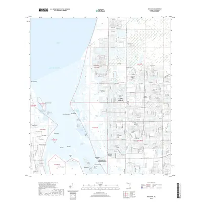
2018 Map of Matlacha
USGS Topo · Published 2018About this map
Cape Coral reveals its intricate residential grid and canal network in this coastal survey, where the expanding suburbs of Lee County meet the complex mangroves and keys of the Florida Gulf Coast. The eastern portion of the map is dominated by a dense web of streets like Caloosa Pkwy and Jacaranda Pkwy, while the western reach transitions into the tidal waters of Charlotte Harbor and the Gulf of Mexico.
Find a feature on this map
198 named features on this map. Tap any name to fly to it.
Don’t see what you’re looking for? This feature index may not catch every label — zoom into the map to look around manually.
Map Details
Editions of this 2018 Matlacha Map
This is the sole edition of this map. No revisions or reprints were ever made.
Other maps of this area

1956 · Punta Gorda SE
USGS Topo · 1:24,000

1956 · West Palm Beach
USGS Topo · 1:250,000

1956 · Tampa
USGS Topo · 1:250,000

1956 · Charlotte Harbor
USGS Topo · 1:250,000

1957 · West Palm Beach
USGS Topo · 1:250,000

1957 · Punta Gorda SW
USGS Topo · 1:24,000

1957 · Gilchrist
USGS Topo · 1:24,000

1958 · West Palm Beach
USGS Topo · 1:250,000

1958 · Matlacha
USGS Topo · 1:24,000

1958 · Captiva
USGS Topo · 1:24,000