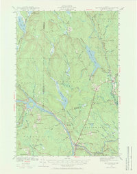
1940 Map of Mattawamkeag
USGS Topo · Published 1969About this map
Mattawamkeag sits at the confluence of the rivers in this 1940 survey, serving as a vital rail hub for the Maine Central railroad. The landscape is defined by the complex hydrology of the Maine woods, where the Mattaseunk Dam regulates the waters of the Penobscot River. To the north, the North Yarmouth Academy Grant represents the era’s large-scale land divisions, while small settlements like Macwahoc and Jordan Mills indicate the localized industry of the time. The transition between Penobscot and Aroostook Counties is clearly marked through a wilderness of bogs and hills, such as Carlton Bog and Webb Hill. This map captures the region when rural schools like North Woodville Sch and South Woodville Sch still anchored local communities, and the river remained central to the regional economy with features like the Boom Islands supporting timber operations.
Find a feature on this map
78 named features on this map. Tap any name to fly to it.
Don’t see what you’re looking for? This feature index may not catch every label — zoom into the map to look around manually.
Map Details
Editions of this 1940 Mattawamkeag Map
2 editions found
Other maps of this area

1920 · Winn
USGS Topo · 1:62,500

1931 · Springfield
USGS Topo · 1:48,000

1934 · Springfield
USGS Topo · 1:62,500

1940 · Sherman
USGS Topo · 1:62,500

1940 · Mattawamkeag
USGS Topo · 1:62,500

1941 · Mattawamkeag Lake
USGS Topo · 1:62,500

1941 · Wytopitlock
USGS Topo · 1:62,500

1942 · Lincoln
USGS Topo · 1:62,500

1942 · Mattawamkeag
USGS Topo · 1:62,500

1942 · Sherman
USGS Topo · 1:62,500