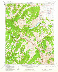
1956 Map of Matterhorn Peak
USGS Topo · Published 1963About this map
Twin Lakes and the settlement at Anaho Village anchor this mid-century topographic survey of the High Sierra. The landscape is defined by the high-elevation boundary between Yosemite National Park and the Toiyabe National Forest, where steep glaciated terrain creates a dense network of alpine water bodies like Peeler Lake, Crown Lake, and Rock Island Lake. The map details the early recreational and industrial footprint of Mono County, showing developed sites such as Honeymoon Flat Campground and the Robinson Creek Campground alongside long-standing livestock operations like the Hunewill Ranch. Mining history is evident at the Tamarack Mine and the May Lundy Mine, while isolated outposts like McMillan Cabin and Bogards Camp indicate the era's sparse but active mountain habitation.
Find a feature on this map
158 named features on this map. Tap any name to fly to it.
Don’t see what you’re looking for? This feature index may not catch every label — zoom into the map to look around manually.
Map Details
Editions of this 1956 Matterhorn Peak Map
4 editions found

Other maps of this area

1896 · Dardanelles
USGS Topo · 1:125,000

1897 · Yosemite
USGS Topo · 1:125,000

1898 · Dardanelles
USGS Topo · 1:125,000

1900 · Yosemite
USGS Topo · 1:125,000

1901 · Mt. Lyell
USGS Topo · 1:125,000

1903 · Yosemite
USGS Topo · 1:125,000

1909 · Yosemite
USGS Topo · 1:125,000

1909 · Bridgeport
USGS Topo · 1:125,000

1911 · Bridgeport
USGS Topo · 1:125,000

1920 · Bridgeport
USGS Topo · 1:125,000