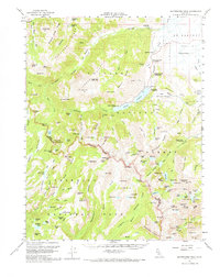
1956 Map of Matterhorn Peak
USGS Topo · Published 1971About this map
Toiyabe National Forest and Yosemite National Park converge at the Sawtooth Ridge, defining a landscape of high-elevation basins and steep drainages in the mid-1950s. The transition from the rugged crests down to the Bridgeport Valley is marked by a network of seasonal camps and early recreational outposts. Mono Village and the Twin Lakes area serve as a focal point for backcountry access, while the Hunewill Ranch represents the agricultural footprint in the lower meadows.
Find a feature on this map
157 named features on this map. Tap any name to fly to it.
Don’t see what you’re looking for? This feature index may not catch every label — zoom into the map to look around manually.
Map Details
Editions of this 1956 Matterhorn Peak Map
4 editions found

Other maps of this area

1896 · Dardanelles
USGS Topo · 1:125,000

1897 · Yosemite
USGS Topo · 1:125,000

1898 · Dardanelles
USGS Topo · 1:125,000

1900 · Yosemite
USGS Topo · 1:125,000

1901 · Mt. Lyell
USGS Topo · 1:125,000

1903 · Yosemite
USGS Topo · 1:125,000

1909 · Yosemite
USGS Topo · 1:125,000

1909 · Bridgeport
USGS Topo · 1:125,000

1911 · Bridgeport
USGS Topo · 1:125,000

1920 · Bridgeport
USGS Topo · 1:125,000