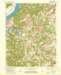
1970 Map of Mattingly
USGS Topo · Published 1972About this map
The Ohio River forms the natural northwestern boundary of this 1970 study, where the waters of Clover Creek and Hites Run drain through the ridges of Breckinridge County. The town of Cloverport stands at the confluence of the river and creek, serving as a hub for the Louisville and Nashville railroad line. Inland, the map reveals a landscape defined by small rural settlements and family-named landmarks, such as Mattingly and Balltown. Numerous small country churches and cemeteries, including New Bethel Ch, Pisgah Ch, and Chapin Cem, are scattered across the winding ridgelines, offering vital data for genealogists. The presence of pipelines and a Quarry near Sheep Run provides evidence of the local industrial footprint, while the state border between Kentucky and Indiana is meticulously traced through the middle of the river channel.
Find a feature on this map
43 named features on this map. Tap any name to fly to it.
Don’t see what you’re looking for? This feature index may not catch every label — zoom into the map to look around manually.
Map Details
Editions of this 1970 Mattingly Map
2 editions found
Other maps of this area

1928 · Hardinsburg
USGS Topo · 1:48,000

1931 · Hardinsburg
USGS Topo · 1:62,500

1932 · Fordsville
USGS Topo · 1:62,500

1934 · Cannelton
USGS Topo · 1:62,500

1947 · Lodiburg
USGS Topo · 1:24,000

1947 · Hardinsburg
USGS Topo · 1:24,000

1947 · Hardinsburg
USGS Topo · 1:62,500

1949 · Cannelton
USGS Topo · 1:24,000

1953 · Cannelton
USGS Topo · 1:24,000

1953 · Hardinsburg
USGS Topo · 1:24,000