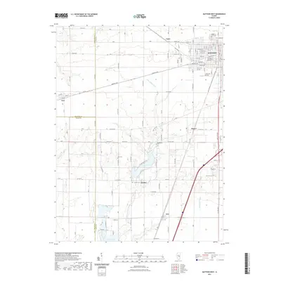
2021 Map of Mattoon West
USGS Topo · Published 2021About this map
The western edge of Mattoon serves as the focal point for this landscape where the agricultural plains of Central Illinois meet a significant water management network. A grid of residential and commercial streets, including Broadway Ave and Marshall Ave, transitions into the rural reaches of Coles, Moultrie, and Shelby Counties. The Little Wabash River watershed is anchored here by Lake Paradise and the northern tip of Lake Mattoon, reservoirs that define the local topography.
Find a feature on this map
77 named features on this map. Tap any name to fly to it.
Don’t see what you’re looking for? This feature index may not catch every label — zoom into the map to look around manually.
Map Details
Editions of this 2021 Mattoon West Map
This is the sole edition of this map. No revisions or reprints were ever made.
Other maps of this area

1934 · Mattoon
USGS Topo · 1:62,500

1935 · Arcola
USGS Topo · 1:48,000

1935 · Sullivan
USGS Topo · 1:48,000

1937 · Mattoon
USGS Topo · 1:62,500

1940 · Sullivan
USGS Topo · 1:62,500

1940 · Arcola
USGS Topo · 1:62,500

1947 · Stewardson
USGS Topo · 1:62,500

1949 · Stewardson
USGS Topo · 1:62,500

1958 · Decatur
USGS Topo · 1:250,000

1961 · Decatur
USGS Topo · 1:250,000