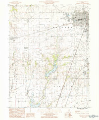
1984 Map of Mattoon West
USGS Topo · Published 1985About this map
The western outskirts of Mattoon anchor this 1980s landscape, where the urban grid gives way to the prairie hydrology of the Little Wabash River and Lake Paradise. This era shows a region defined by its infrastructure and education, notably featuring the campus of Lake Land Jr College and the industrial activity within the Oil Field and numerous Sand and Gravel Pits dotting the terrain. The meeting of Moultrie, Coles, and Shelby counties creates a complex administrative borderland marked by small railroad-aligned settlements and rural hamlets.
Find a feature on this map
28 named features on this map. Tap any name to fly to it.
Don’t see what you’re looking for? This feature index may not catch every label — zoom into the map to look around manually.
Map Details
Editions of this 1984 Mattoon West Map
This is the sole edition of this map. No revisions or reprints were ever made.
Other maps of this area

1934 · Mattoon
USGS Topo · 1:62,500

1935 · Arcola
USGS Topo · 1:48,000

1935 · Sullivan
USGS Topo · 1:48,000

1937 · Mattoon
USGS Topo · 1:62,500

1940 · Sullivan
USGS Topo · 1:62,500

1940 · Arcola
USGS Topo · 1:62,500

1947 · Stewardson
USGS Topo · 1:62,500

1949 · Stewardson
USGS Topo · 1:62,500

1958 · Decatur
USGS Topo · 1:250,000

1961 · Decatur
USGS Topo · 1:250,000