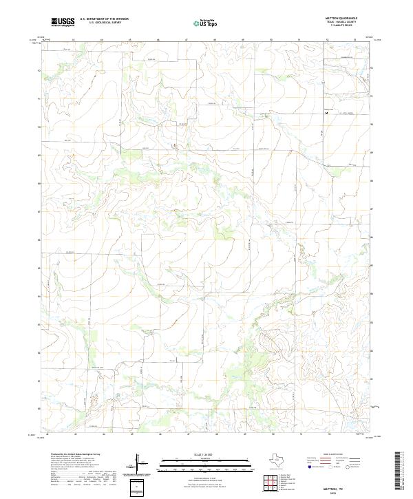
2022 Map of Mattson
USGS Topo · Published 2022About this map
Brushy Cr and Millers Cr wind across this Haskell County landscape, carving through a region defined by agricultural land and cattle tanks. The topography reveals a sparsely settled area where water management is central to the local economy, anchored by features like Elm Cr Tank. The northern edge of the map features the H C (Pick) Yandell settlement and the Brushy Cem, providing key points of interest for genealogists researching family ties in this part of Texas. A network of rural roads, including FM 1720 and Ranch Rd 266, connects the isolated farmsteads and ranching operations that characterize the drainage basins of Wild Horse Cr and Lake Cr.
Find a feature on this map
28 named features on this map. Tap any name to fly to it.
Don’t see what you’re looking for? This feature index may not catch every label — zoom into the map to look around manually.
Map Details
Editions of this 2022 Mattson Map
This is the sole edition of this map. No revisions or reprints were ever made.
Other maps of this area

1954 · Wichita Falls
USGS Topo · 1:250,000

1958 · Wichita Falls
USGS Topo · 1:250,000

1962 · Antelope Creek SW
USGS Topo · 1:24,000

1962 · Antelope Creek NW
USGS Topo · 1:24,000

1965 · Reynolds Bend NW
USGS Topo · 1:24,000

1966 · Haskell
USGS Topo · 1:24,000
1966 · Irby
USGS Topo · 1:24,000

1967 · Weinert
USGS Topo · 1:24,000

1967 · Mattson
USGS Topo · 1:24,000

1968 · Munday West
USGS Topo · 1:24,000