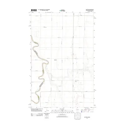
2013 Map of Mattson
USGS Topo · Published 2013About this map
The Red River of the North defines the western edge of this landscape, forming the winding border between Kittson County, Minnesota, and Pembina County, North Dakota. The river's serpentine course creates deep meanders that shift across the flat valley floor, influencing the layout of local roads and property boundaries. The small settlement of Mattson sits centrally in a grid of township roads that service the surrounding agricultural land. Local history and genealogy are anchored by two significant sites: the Tabitha Lutheran Cem to the northwest and the Red River Cem located further south near the riverbank. This 2013 survey illustrates the persistence of these rural landmarks alongside a modern transportation network, including Co Hwy-1 and Co Hwy-7, which facilitate movement through this remote borderland region.
Find a feature on this map
37 named features on this map. Tap any name to fly to it.
Don’t see what you’re looking for? This feature index may not catch every label — zoom into the map to look around manually.
Map Details
Editions of this 2013 Mattson Map
This is the sole edition of this map. No revisions or reprints were ever made.
Other maps of this area

1939 · Drayton
USGS Topo · 1:62,500

1939 · Pembina
USGS Topo · 1:62,500

1939 · Kennedy
USGS Topo · 1:62,500

1941 · Kennedy
USGS Topo · 1:62,500

1941 · Drayton
USGS Topo · 1:62,500

1941 · Hallock
USGS Topo · 1:62,500

1941 · Pembina
USGS Topo · 1:62,500

1952 · Thief River Falls
USGS Topo · 1:250,000

1956 · Thief River Falls
USGS Topo · 1:250,000

1957 · Thief River Falls
USGS Topo · 1:250,000