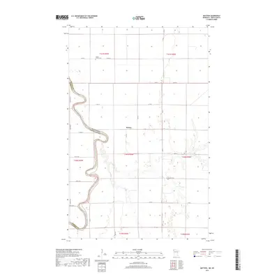
2019 Map of Mattson
USGS Topo · Published 2019About this map
The Red River of the North carves a complex, meandering path along the border of Minnesota and North Dakota, defining the western edge of Kittson County. This 2019 survey captures the agrarian character of the Red River Valley, where the small settlement of Mattson sits amidst a strictly organized grid of county roads. The landscape is marked by its flat, fertile floor and the dramatic oxbows of the river, which serves as a natural boundary between Pembina and Kittson counties.
Find a feature on this map
28 named features on this map. Tap any name to fly to it.
Don’t see what you’re looking for? This feature index may not catch every label — zoom into the map to look around manually.
Map Details
Editions of this 2019 Mattson Map
This is the sole edition of this map. No revisions or reprints were ever made.
Other maps of this area

1939 · Drayton
USGS Topo · 1:62,500

1939 · Pembina
USGS Topo · 1:62,500

1939 · Kennedy
USGS Topo · 1:62,500

1941 · Kennedy
USGS Topo · 1:62,500

1941 · Drayton
USGS Topo · 1:62,500

1941 · Hallock
USGS Topo · 1:62,500

1941 · Pembina
USGS Topo · 1:62,500

1952 · Thief River Falls
USGS Topo · 1:250,000

1956 · Thief River Falls
USGS Topo · 1:250,000

1957 · Thief River Falls
USGS Topo · 1:250,000