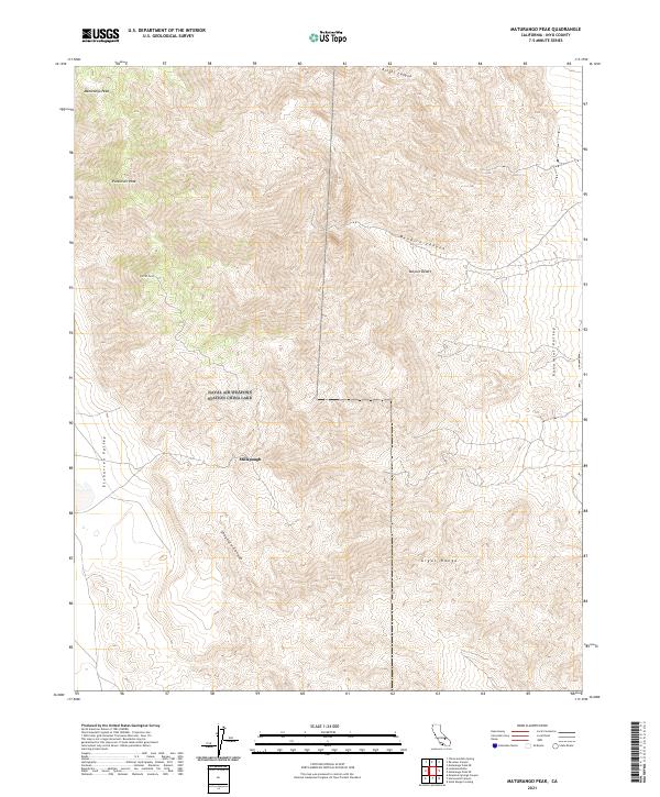
2021 Map of Maturango Peak
USGS Topo · Published 2021About this map
Millspaugh sits at the heart of this high-elevation terrain, marking a point of human presence within the eastern edge of the Argus Range. This modern survey illustrates the complex topography between the Mojave Desert and the Panamint Valley, where dramatic peaks like Maturango Peak and Parkinson Peak define the skyline. The map reveals an intricate drainage system including Shepherd Canyon, Bendre Canyon, and Knight Canyon, reflecting the watershed patterns of the upper Inyo county desert. These deep canyons and high points, such as Parrot Point, provide a clear picture of the landform transitions from the high peaks down into Etcharren Valley. For those studying the geography of this portion of California, the map documents the relationship between established land boundaries and the natural barriers of the desert mountains.
Find a feature on this map
17 named features on this map. Tap any name to fly to it.
Don’t see what you’re looking for? This feature index may not catch every label — zoom into the map to look around manually.
Map Details
Editions of this 2021 Maturango Peak Map
This is the sole edition of this map. No revisions or reprints were ever made.
Other maps of this area

1908 · Ballarat
USGS Topo · 1:250,000

1913 · Ballarat
USGS Topo · 1:250,000

1915 · Searles Lake
USGS Topo · 1:250,000

1947 · Trona
USGS Topo · 1:250,000

1948 · Trona
USGS Topo · 1:250,000

1948 · Death Valley
USGS Topo · 1:250,000

1949 · Trona
USGS Topo · 1:62,500

1950 · Trona
USGS Topo · 1:62,500

1951 · Maturango Peak
USGS Topo · 1:62,500

1951 · Coso Peak
USGS Topo · 1:62,500