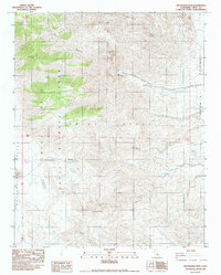
1982 Map of Maturango Peak
USGS Topo · Published 1983About this map
The Argus Range dominates this landscape in the early 1980s, serving as a backdrop for both military operations and historic mining activity. A significant portion of the territory is defined by the China Lake Naval Weapons Center, illustrating the intersection of California's high desert wilderness with national defense infrastructure. Historically, the area was tied to mineral extraction, evidenced by the Copper King Mine and the Onyx Mine Quarry.
Find a feature on this map
16 named features on this map. Tap any name to fly to it.
Don’t see what you’re looking for? This feature index may not catch every label — zoom into the map to look around manually.
Map Details
Editions of this 1982 Maturango Peak Map
This is the sole edition of this map. No revisions or reprints were ever made.
Other maps of this area

1908 · Ballarat
USGS Topo · 1:250,000

1913 · Ballarat
USGS Topo · 1:250,000

1915 · Searles Lake
USGS Topo · 1:250,000

1947 · Trona
USGS Topo · 1:250,000

1948 · Trona
USGS Topo · 1:250,000

1948 · Death Valley
USGS Topo · 1:250,000

1949 · Trona
USGS Topo · 1:62,500

1950 · Trona
USGS Topo · 1:62,500

1951 · Maturango Peak
USGS Topo · 1:62,500

1951 · Coso Peak
USGS Topo · 1:62,500