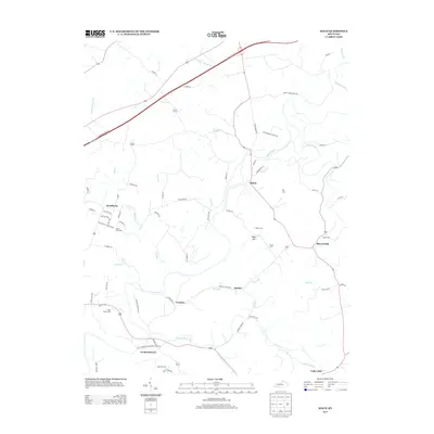
2013 Map of Maud
USGS Topo · Published 2013About this map
Fredericktown and the surrounding Nelson County countryside are defined by a network of winding waterways and family-named homesteads. The landscape is carved by the Beech Fork and the Chaplin River, which create a complex drainage system including Hog Run, Doe Run, and Cartwright Cr. In this early 21st-century study, rural settlements such as Woodlawn, Maud, and Mooresville anchor the agricultural region, connected by local routes like the Old Fredericktown-Bardstown Rd. The map is particularly rich in genealogical sites, noting numerous small burial grounds such as Settle Cem, Tucker Cem, and Holy Trinity Cem. These landmarks, along with terrain features like Mayo Hill, reflect a long history of land ownership and community clusters that have persisted as the area transitioned into a modern crossroads near the Bluegrass Pkwy W.
Find a feature on this map
64 named features on this map. Tap any name to fly to it.
Don’t see what you’re looking for? This feature index may not catch every label — zoom into the map to look around manually.
Map Details
Editions of this 2013 Maud Map
This is the sole edition of this map. No revisions or reprints were ever made.
Other maps of this area

1952 · Chaplin
USGS Topo · 1:24,000

1953 · Loretto
USGS Topo · 1:24,000

1953 · Brush Grove
USGS Topo · 1:24,000

1953 · Maud
USGS Topo · 1:24,000

1953 · Saint Catharine
USGS Topo · 1:24,000

1953 · Bardstown
USGS Topo · 1:24,000

1953 · Springfield
USGS Topo · 1:24,000

1953 · Bloomfield
USGS Topo · 1:24,000

1953 · Fairfield
USGS Topo · 1:24,000

1957 · Winchester
USGS Topo · 1:250,000