
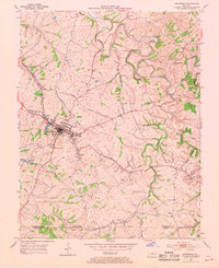
1953 Map of Springfield
USGS Topo · Published 1954About this map
The town of Springfield, Kentucky, serves as a central hub in this early 1950s survey, where the convergence of the Louisville Road and Nashville Road dictates the local geometry. The surrounding Washington County landscape is defined by the winding course of the Beech Fork and its numerous tributaries, such as Haydon Branch and Pleasant Run. Small, family-named settlements and crossroads like Briartown, Jimtown, and Simstown dot the countryside, reflecting a decentralized rural community structure common to the era.
Find a feature on this map
39 named features on this map. Tap any name to fly to it.
Don’t see what you’re looking for? This feature index may not catch every label — zoom into the map to look around manually.
Map Details
Editions of this 1953 Springfield Map
2 editions found
Other maps of this area

1953 · Mackville
USGS Topo · 1:24,000

1953 · Brush Grove
USGS Topo · 1:24,000

1953 · Gravel Switch
USGS Topo · 1:24,000

1953 · Maud
USGS Topo · 1:24,000

1953 · Saint Catharine
USGS Topo · 1:24,000

1953 · Lebanon East
USGS Topo · 1:24,000

1953 · Cardwell
USGS Topo · 1:24,000

1953 · Lebanon West
USGS Topo · 1:24,000

1957 · Winchester
USGS Topo · 1:250,000

1960 · Winchester
USGS Topo · 1:250,000