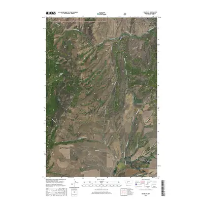
2017 Map of Maudlow
USGS Topo · Published 2017About this map
Maudlow sits at the northern end of this Montana landscape, where the waters of Sixteenmile Cr cut through the steep walls of Sixteenmile Canyon. The area is characterized by the complex topography of the Horseshoe Hills and various canyons, including the narrow corridor of Little Rocky Canyon to the southeast. To the north, the boundary of the Helena National Forest marks a transition into protected timberlands. The human footprint is defined by isolated rural lanes like Neinfeldt Ln and Morgan Ln that trace the drainage basins of Dry Cr and Blacktail Cr. Toponymic details such as Poison Hollow, Roy Gulch, and Haw Gulch reflect a history of ranching and exploration in this part of Gallatin County, while Rowland Spring indicates essential water sources in an otherwise high-elevation, semi-arid environment.
Find a feature on this map
28 named features on this map. Tap any name to fly to it.
Don’t see what you’re looking for? This feature index may not catch every label — zoom into the map to look around manually.
Map Details
Editions of this 2017 Maudlow Map
This is the sole edition of this map. No revisions or reprints were ever made.
Other maps of this area

1886 · Fort Logan
USGS Topo · 1:250,000

1888 · Three Forks
USGS Topo · 1:250,000

1894 · Three Forks
USGS Topo · 1:250,000

1895 · Three Forks
USGS Topo · 1:250,000

1947 · Bozeman
USGS Topo · 1:250,000

1948 · Bozeman
USGS Topo · 1:250,000

1948 · White Sulphur Springs
USGS Topo · 1:250,000

1949 · Manhattan
USGS Topo · 1:62,500

1949 · Maudlow
USGS Topo · 1:62,500

1949 · Toston
USGS Topo · 1:62,500