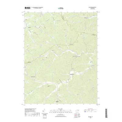
2019 Map of Maulden
USGS Topo · Published 2019About this map
Island City and Burning Springs anchor a landscape defined by the deep dissection of the Cumberland Plateau, where settlement follows the winding courses of Sexton Creek and Sturgeon Cr. The map reveals a high density of family-named cemeteries, such as Wilson Cem and Cradlebow Cem, which are scattered across the ridges and hollows, providing essential data for genealogical research. The transition between Jackson, Clay, and Owsley counties is marked by narrow valleys like Thomas Hollow and significant heights such as Silvermine Ridge. The distribution of small communities like Chestnutburg, Maulden, and Sourwood suggests a persistent rural heritage centered on the creek branches. This 2019 survey documents the enduring physical footprint of these upland settlements, from the bottomlands of Falls Lick to the high gap at Clay Gap.
Find a feature on this map
89 named features on this map. Tap any name to fly to it.
Don’t see what you’re looking for? This feature index may not catch every label — zoom into the map to look around manually.
Map Details
Editions of this 2019 Maulden Map
This is the sole edition of this map. No revisions or reprints were ever made.
Other maps of this area

1891 · Manchester
USGS Topo · 1:125,000

1952 · Portersburg
USGS Topo · 1:24,000

1952 · Manchester
USGS Topo · 1:24,000

1953 · Mc Kee
USGS Topo · 1:24,000

1953 · Oneida
USGS Topo · 1:24,000

1953 · Tyner
USGS Topo · 1:24,000

1953 · Booneville
USGS Topo · 1:24,000

1953 · Sturgeon
USGS Topo · 1:24,000

1954 · Barcreek
USGS Topo · 1:24,000

1954 · Maulden
USGS Topo · 1:24,000