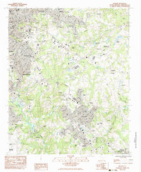
1983 Map of Mauldin
USGS Topo · Published 1983About this map
The Reedy River corridor anchors this Greenville County study, tracing the southward expansion of the upstate urban centers in the early 1980s. The landscape is defined by a dense network of suburban development and institutional hubs, ranging from the campus of Bob Jones University in the north to the industrial footprint of the Donaldson Center Airport in the south. Between these points, the burgeoning settlements of Mauldin and Simpsonville show significant growth along the Seaboard rail line and major road arteries.
Find a feature on this map
63 named features on this map. Tap any name to fly to it.
Don’t see what you’re looking for? This feature index may not catch every label — zoom into the map to look around manually.
Map Details
Editions of this 1983 Mauldin Map
2 editions found
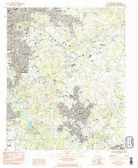
Other maps of this area

1935 · Greer
USGS Topo · 1:48,000

1935 · Greenville
USGS Topo · 1:48,000

1938 · Greenville
USGS Topo · 1:62,500

1938 · Greer
USGS Topo · 1:62,500

1954 · Greenville
USGS Topo · 1:250,000

1957 · Fountain Inn
USGS Topo · 1:62,500

1957 · Greenville
USGS Topo · 1:24,000

1957 · Williamston
USGS Topo · 1:62,500

1957 · Greer
USGS Topo · 1:62,500

1957 · Greenville
USGS Topo · 1:62,500