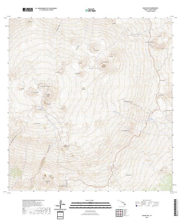
2024 Map of Mauna Kea
USGS Topo · Published 2024About this map
Mauna Kea dominates the summit landscape of the Island of Hawai‘i, surrounded by a dense cluster of cinder cones such as Pu‘uhoaka, Pu‘uuhau‘oki, and Pu‘uwekiu. The high-altitude terrain is marked by distinctive geological features, including the rare alpine Lake Waiau and the beginnings of major drainage systems like the Wailuku River and Waipāhoehoe Gulch. This 2024 survey documents the network of paths and modernization around the summit, notably the Mauna Kea Access Road Trl winding through areas like Pu‘ukalepeamoa. The map provides a detailed record of the traditional and contemporary names for the numerous pu‘u (hills) and gulches, reflecting both the spiritual and scientific significance of this unique volcanic environment.
Find a feature on this map
40 named features on this map. Tap any name to fly to it.
Don’t see what you’re looking for? This feature index may not catch every label — zoom into the map to look around manually.
Map Details
Editions of this 2024 Mauna Kea Map
This is the sole edition of this map. No revisions or reprints were ever made.
Other maps of this area

1927 · Kaohe
USGS Topo · 1:62,500

1930 · Humuula
USGS Topo · 1:62,500

1930 · Kaohe
USGS Topo · 1:62,500

1954 · Hawaii North
USGS Topo · 1:250,000

1956 · Puu Oo
USGS Topo · 1:24,000

1956 · Pua Akala
USGS Topo · 1:24,000

1956 · Puu Koli
USGS Topo · 1:24,000

1956 · Keanakolu
USGS Topo · 1:24,000

1956 · Upper Piihonua
USGS Topo · 1:24,000

1956 · Makahalau
USGS Topo · 1:24,000