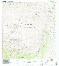
1993 Map of Mauna Kea
USGS Topo · Published 2001About this map
Mauna Kea Observatories crown the volcanic heights of this high-elevation quadrangle, where scientific infrastructure meets deeply significant terrain. The landscape is dominated by numerous cinder cones, including Pu'uwekiu and Pu'upoli'ahu, alongside the remarkable Lake Waiau nestled near the summit. Large protected tracts define the region, such as the Mauna Kea Ice Age Natural Area Reserve and the Ka'ohe Mauna Kea Forest Reserve, which safeguard unique geological and biological features.
Find a feature on this map
45 named features on this map. Tap any name to fly to it.
Don’t see what you’re looking for? This feature index may not catch every label — zoom into the map to look around manually.
Map Details
Editions of this 1993 Mauna Kea Map
This is the sole edition of this map. No revisions or reprints were ever made.
Other maps of this area

1927 · Kaohe
USGS Topo · 1:62,500

1930 · Humuula
USGS Topo · 1:62,500

1930 · Kaohe
USGS Topo · 1:62,500

1954 · Hawaii North
USGS Topo · 1:250,000

1956 · Puu Oo
USGS Topo · 1:24,000

1956 · Pua Akala
USGS Topo · 1:24,000

1956 · Puu Koli
USGS Topo · 1:24,000

1956 · Keanakolu
USGS Topo · 1:24,000

1956 · Upper Piihonua
USGS Topo · 1:24,000

1956 · Makahalau
USGS Topo · 1:24,000