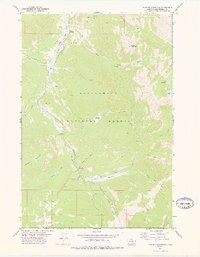
1978 Map of Maurice Mountain
USGS Topo · Published 1978About this map
Maurice Mountain dominates this portion of the Beaverhead National Forest, where high-altitude meadows and timbered slopes define the landscape. The western corridor is marked by the path of the Wise River, which is paralleled by the Old Wise River Railroad Grade. This transport relic suggests the area's industrial past, likely tied to timber or mining interests that once moved through the valley. Nearby, the Maurice Cemetery and Maurice Pond stand as small but significant markers of early settlement activity in this remote terrain.
Find a feature on this map
34 named features on this map. Tap any name to fly to it.
Don’t see what you’re looking for? This feature index may not catch every label — zoom into the map to look around manually.
Map Details
Editions of this 1978 Maurice Mountain Map
This is the sole edition of this map. No revisions or reprints were ever made.
Other maps of this area

1893 · Dillon
USGS Topo · 1:250,000

1952 · Torrey Mountain
USGS Topo · 1:24,000

1955 · Dillon
USGS Topo · 1:250,000

1957 · Dillon
USGS Topo · 1:250,000

1958 · Dillon
USGS Topo · 1:250,000

1958 · Vipond Park
USGS Topo · 1:62,500

1959 · Polaris
USGS Topo · 1:62,500

1962 · Dillon
USGS Topo · 1:250,000

1965 · Dillon
USGS Topo · 1:250,000
1975 · Butte South
USGS Topo · 1:100,000