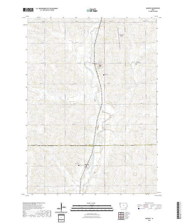
2022 Map of Maurice
USGS Topo · Published 2022About this map
The West Branch Floyd River carves a path through the agricultural landscape of this corner of northwest Iowa, where the small community of Maurice serves as a central hub. The terrain is defined by a rhythmic grid of rural roads, including Co Rd B58 and Co Rd C12, which connect isolated farmsteads to local centers. To the south, the settlement of Struble sits just across the boundary line in Plymouth County.
Find a feature on this map
26 named features on this map. Tap any name to fly to it.
Don’t see what you’re looking for? This feature index may not catch every label — zoom into the map to look around manually.
Map Details
Editions of this 2022 Maurice Map
This is the sole edition of this map. No revisions or reprints were ever made.
Other maps of this area

1955 · Sioux City
USGS Topo · 1:250,000

1955 · Sioux Falls
USGS Topo · 1:250,000

1958 · Sioux City
USGS Topo · 1:250,000

1958 · Sioux Falls
USGS Topo · 1:250,000

1959 · Sioux City
USGS Topo · 1:250,000

1962 · Le Mars
USGS Topo · 1:62,500

1964 · Orange City
USGS Topo · 1:24,000

1964 · Sioux Center
USGS Topo · 1:24,000

1968 · Labanon
USGS Topo · 1:24,000
1969 · Ireton
USGS Topo · 1:24,000