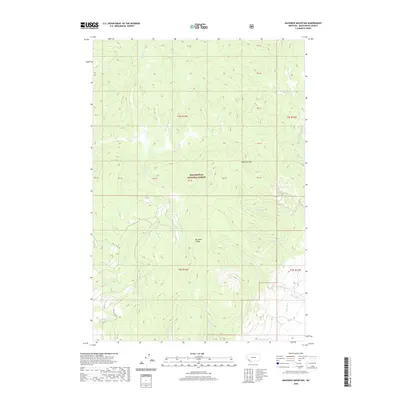
2020 Map of Maverick Mountain
USGS Topo · Published 2020About this map
Maverick Mtn stands as a prominent landmark within the Beaverhead National Forest in this portion of Beaverhead County. The landscape is defined by the Big Hole Divide, a significant topographical feature that separates the complex drainage systems of the region. The map reveals an intricate network of mountain streams, including Grasshopper Cr and Beaver Cr to the north, and Cottonwood Cr and Neagle Cr to the south.
Find a feature on this map
28 named features on this map. Tap any name to fly to it.
Don’t see what you’re looking for? This feature index may not catch every label — zoom into the map to look around manually.
Map Details
Editions of this 2020 Maverick Mountain Map
This is the sole edition of this map. No revisions or reprints were ever made.
Other maps of this area

1955 · Dillon
USGS Topo · 1:250,000

1957 · Dillon
USGS Topo · 1:250,000

1958 · Dillon
USGS Topo · 1:250,000

1959 · Polaris
USGS Topo · 1:62,500

1962 · Dillon
USGS Topo · 1:250,000

1962 · Stewart Mountain
USGS Topo · 1:24,000

1965 · Dillon
USGS Topo · 1:250,000
1978 · Odell Lake
USGS Topo · 1:24,000
1978 · Maurice Mountain
USGS Topo · 1:24,000

1978 · Butch Hill
USGS Topo · 1:24,000