
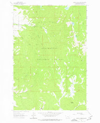
1962 Map of Stewart Mountain
USGS Topo · Published 1964About this map
Beaverhead National Forest defines the high-altitude landscape of this 1960s survey, dominated by the peaks of Stewart Mountain and Odell Mountain. The map illustrates a specialized high-country economy focused on resource extraction and federal management, centered at the Steel Creek Ranger Station. Scattered mining claims like the Arnold Mine and Maynard Mine are connected by a network of pack trails and jeep trails that navigate the steep drainages of Steel Creek and Warm Springs Creek.
Find a feature on this map
33 named features on this map. Tap any name to fly to it.
Don’t see what you’re looking for? This feature index may not catch every label — zoom into the map to look around manually.
Map Details
Editions of this 1962 Stewart Mountain Map
2 editions found
Other maps of this area

1955 · Dillon
USGS Topo · 1:250,000

1957 · Dillon
USGS Topo · 1:250,000

1958 · Dillon
USGS Topo · 1:250,000

1959 · Polaris
USGS Topo · 1:62,500

1962 · Dillon
USGS Topo · 1:250,000

1962 · Wisdom
USGS Topo · 1:24,000

1962 · Mud Lake
USGS Topo · 1:24,000

1962 · Proposal Rock
USGS Topo · 1:24,000

1965 · Dillon
USGS Topo · 1:250,000
1978 · Odell Lake
USGS Topo · 1:24,000