
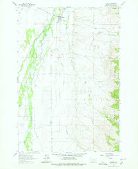
1962 Map of Wisdom
USGS Topo · Published 1964About this map
Wisdom serves as the central hub of this Montana landscape, situated at the edge of the sprawling Big Hole River valley. The map reveals the intricate drainage patterns of the high country, where dozens of mountain streams like Samrun Creek and Stanley Creek feed into the river's winding course. This era shows a community balanced between traditional ranching, forest management at the Ranger Station, and early aviation at the Wisdom Airport.
Find a feature on this map
18 named features on this map. Tap any name to fly to it.
Don’t see what you’re looking for? This feature index may not catch every label — zoom into the map to look around manually.
Map Details
Editions of this 1962 Wisdom Map
2 editions found
Other maps of this area

1955 · Dillon
USGS Topo · 1:250,000

1957 · Dillon
USGS Topo · 1:250,000

1958 · Dillon
USGS Topo · 1:250,000

1962 · Dillon
USGS Topo · 1:250,000

1962 · Mud Lake
USGS Topo · 1:24,000

1962 · Stewart Mountain
USGS Topo · 1:24,000

1962 · Proposal Rock
USGS Topo · 1:24,000

1965 · Dillon
USGS Topo · 1:250,000

1966 · Gibbons School
USGS Topo · 1:24,000
1966 · Ajax Ranch
USGS Topo · 1:24,000